Tag Archives: gis

Catalunya Lego map

I stumbled upon a lego map in twitter and I thought it was quite fun and I should do something similar:

And here’s the result. One with NaturalEarth data colours for height, and another one with a set of official lego colours ๐Ÿ˜€

..
NOTE from the future:
Since everybody in twitter was to keen to remind me, First the map in EPSG:25831, then in 4236 ๐Ÿ˜€

..

more

Advertisement

Leave a comment

Filed under curious, gis

Flattening the Earth: Two Thousand Years of Map Projections

This book can be summarized by: Excellent text about projections, also a very dry read.

I understand the aim of it, more of a history on map projections, the importance of them on a given period of time, and what they brought to the table.

As a scholar text it is really complete and thorough (there’s up to 35 pages of referenced works). As something to read from beginning to end it is quite boring. It’s better to read bit by bit when you feel like it. And be ready to concentrate on the contents, otherwise most of what it tries to tell you will just go over your head.

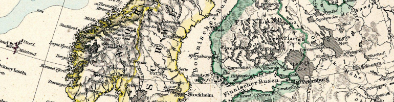
The book contents are plain but beautiful, full renderings of different map projections help give you an overview on how older maps were built. But at the same time I miss some real scans of old maps where we can see those projections in use. Being a history book would be really nice to present both a rendering alongside a real scan. The few cases where a scan is next to the rendering provide a good context to the projection.

Can’t finish this without commenting about fun excerpts of old descriptions of the projections, for example Ptolemy‘s take on his favourite projection:

(…) Although for these reasons this method of drawing the map is the better one, yet it is less satisfactory in this respect, that it is not as simple as the other…. for me both here and everywhere the better and more difficult scheme is preferable to the one which is poorer and easier, yet both methods are to me retained for the sake of those who, through laziness, are drawn to that certain easier method (…)

— Translation From Stevension 1932,

Full projections are described using this really old language as an example on how the knowledge was passed along before modern mathematics. Luckily, alognside those there’s a description from the author (John P. Synder) which makes everything much clearer.

Not a book I would recommend to everyone, but a really cool book to have in your bookshelf for some short bursts of reading.

Note

I did not finish reading this book yet. I’ve read the renaissance projections chapter and skimmed the nineteenth century projections chapter. (2 of 4 total chapters). Missing chapters on 1670-1799 and the twentieth century.

Leave a comment

Filed under books, gis, Maps

Geo Django Raster Metadata

I’ve been using GeoDjango for some time now, and found myself in a situation where I wanted to retrieve raster metadata using the ST_MetaData function on some datasets stored in PostGIS.

To do so, you can of course use the raw function from the db Manager, but for this I went the extra mile (although, it’s more like the extra half-mile, since it’s very easy)

the ST_Metadata in GeoDjango

Leave a comment

Filed under code, curious, tips

Google earth and WMS

A year ago, my sister gave me an awesome present. A big set of small card-sized photos with a set of the highest mountains of Catalunya. The idea is to write on the back when and with whom I “climbed” that mountain.

Last Easter I was planning which closer hikes could I do during the holidays, so I can start filling each card (feels like gotta climb em’ all). It was difficult to know each mountain location from the cards, I fired Google Earth for Linux and started creating points.

It was very easy with the famous ones, since Google Earth finds them directly (Pedraforca, Pica d’estats, etc..), but more obscure ones are a no-no. So I needed extra support to map them.

Mountain Cards

Mountain Cards

more

4 Comments

Filed under gis, Maps

DBPedia Daily Map

dbpediamaplogo

I am pleased to announce the DBPedia Places map. Since I wrote my master thesis about vague places I wanted to do something like this. The vague-places generator was one of the outputs of such work, but I felt the need to see DBpedia points on a map, changing every day.

The final result can be poked at the dbpediamap.tk, this post is an overview of how this small project works.

As a quick taste, here’s a screenshot showing a dataset presented on the website:

DBpedia viewer USA

DBpedia viewer USA

Explain me a little bit more

1 Comment

Filed under code, gis, Maps

Europe DbPedia 2017

europeflagdbpedia
I was kind of bored while doing some work, and just past week we were discussing with a colleague about my vague-places project.

This project was forgotten in time, but today I’ve blown the dust away, recovered it, and updated the Europe DbPedia map.

Image overview

Most of you won’t be interested in the full story. So here, see a set of results. If something picks your interest (like, why Portugal has almost no points) just keep reading ๐Ÿ˜€

Keep Reading

2 Comments

Filed under curious, gis, Maps