

A year ago, my sister gave me an awesome present. A big set of small card-sized photos with a set of the highest mountains of Catalunya. The idea is to write on the back when and with whom I “climbed” that mountain.
Last Easter I was planning which closer hikes could I do during the holidays, so I can start filling each card (feels like gotta climb em’ all). It was difficult to know each mountain location from the cards, I fired Google Earth for Linux and started creating points.
It was very easy with the famous ones, since Google Earth finds them directly (Pedraforca, Pica d’estats, etc..), but more obscure ones are a no-no. So I needed extra support to map them.

Mountain Cards
What I want to do
Since Google earth does not present accurate topographic maps by default, I want to rely on topographic web map services to present the data in the application. This way I can pinpoint myself where the mountain is located.
ICGC (Institut Cartogràfic i Geològic de Catalunya)
This is the old ICC, the official institute that provides maps, Geo indices and everything related to Catalan cartography.
It is a good resource of information, and they also provide a Web Map Service that contains different topographic bases of Catalunya:
This WMS provides different layers, the interesting ones in my case are the topographic 1:5000 and 1:1000, that I will use to track and ensure that I position the mountains accordingly.
Google Earth and WMS
The way Google earth handles WMS is not direct, but not so difficult either. What it will do is add a new layer that is updated every time the zoom changes.
Add -> Image Overlay
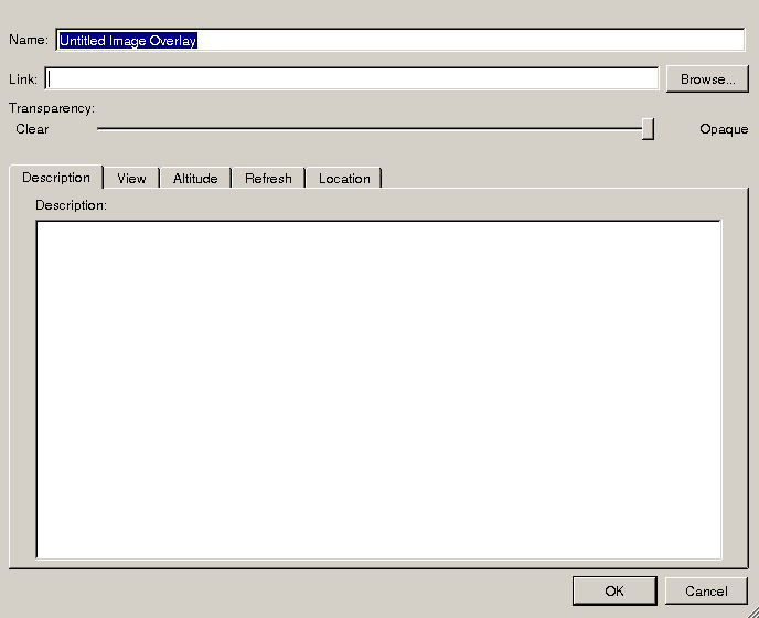
Google Earth add image overlay
The dialog that appears lets us introduce the WMS URL directly. But, AFAIK, you won’t get any results doing that. What you have to do is go to the Refresh tab, and open the WMS Parameters dialog.
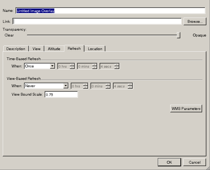
Google Earth WMS refresh tab. Note the WMS Parameters button

Google Earth WMS layers dialog
On that dialog, introduce your WMS URL, and google earth will list the layers available from the URL. Select the layers that you want to do and accept.
Once you have accepted all the dialogs, a new layer appears in the “Places” list. This is the layer that will present the topographical image. You can change all options by right-clicking the image and selecting properties, the dialog is the same as presented above.
-
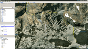
- Google Earth view of Pica d’estats
-
- Google Earth view of Pica d’estats
-
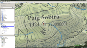
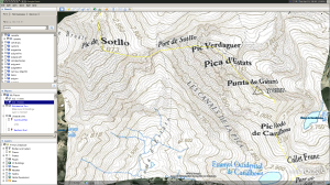
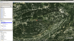
- Google Earth view of Puig Sobirà
-
- Google Earth view of Puig Sobirà
And well that’s it 🙂 happy mapping.
Some photos (As an extra)


Google Earth will auto-refresh every defined point… I think 30 seconds or something… and it will burden WMS server if they only serve static map.
I think Leaflet JS with WMS support will tile the request according to Slippy Map Algorithm (WebGIS)… and I think it will lower server load, since most of tiles will be cached on client’s browser.
But, you need to know a little JavaScript…
for your case, Google Maps is better…
great post, thanks for the share
For this post I’m not thinking as a techie guy, I’m simply visualizing my data with the closest tool I have (Google Earth). At the end I have a file that I can load in almost any computer.
In the post itself I address your concert about the refresh rate, there’s even a “Refresh” tab as the overlay option. Did not check if it did what it claims, just assumed it does. I could use a network sniffer to ensure that it’s not doing anything funny… too much work.
If you enjoy slippy maps with leaflet, take a look at https://jcastellssala.com/2017/02/12/dbpedia-daily-map/ (that’s a small implementation I did in the past)
Thanks for the comment
sorry, I meant Google Earth… not Google Maps…
*my bad
Pingback: The dropped posts, and 2017 closing | Castells